| Map of Burma.. | Geographic Profile. |
| People of Burma. | Rangoon (Yangon). |
| Religion, Education, and Health . | Government and History. |
| Current Flag of Burma. | Tourist Info Links. |
Return To Burma Page
Map of Burma
Back to Top
Geographic Profile.
Back to Top
The Union of Myanmar, known as Burma until mid-1989, is the land of the great Irrawaddy, or Ayeyarwady, River. Most of the country's people live in the fertile lowlands drained by the river. Foreign products and travelers come through Rangoon (Yangon), Myanmar's capital. Myanmar is bordered by China, Laos, Thailand, the Andaman Sea and the Bay of Bengal, Bangladesh, and India.
Myanmar is mountainous. Its parallel ranges are separated by the north-south valleys of the Irrawaddy, the Salween, and the Sittang rivers. The Irrawaddy and the Salween rise high in the Tibetan Highlands of China. The Irrawaddy Valley may be divided into three parts. The narrow, thinly populated upper valley reaches to about 50 miles (80 kilometers) north of Mandalay and receives other swift mountain streams. Much of the broader middle valley is known as the dry zone because its rainfall is low.
The lower valley, which is the delta region, extends 180 miles (290 kilometers) upstream from the sea. A range of low mountains, the Pegu Yoma, runs east of the Irrawaddy.
At the south end of the Irrawaddy Valley is the Arakan Yoma. Here the highest elevations rise to almost 13,000 feet (4,000 meters). West of the Arakan Yoma lies the state of Arakan, along the Bay of Bengal.
The highlands to the northeast and east include the Shan Plateau, which averages about 3,000 feet (900 meters). The Salween River flows through in a deep, narrow valley. Myanmar's southern panhandle is the Tenasserim (Tanintharyi) division. It is on the Isthmus of Kra, which links Malaysia to continental Asia.
Most of Myanmar receives heavy rainfall, almost all in summer. The Arakan and Tenasserim regions receive up to 200 inches (500 centimeters) a year. From 60 to 100 inches (150 to 250 centimeters) fall in the Irrawaddy Delta and between 40 and 80 inches (100 and 200 centimeters) in the eastern highlands and in the north. Parts of the dry zone, in the middle Irrawaddy Basin, get less than 40 inches each year.
Almost 50 percent of Myanmar is forested. Where the rainfall is greatest, broad-leaved evergreen rain forests are common. Where there is less rainfall, the forests have trees that lose their leaves in the dry season. Teak is the best known of these trees. In prehistoric times the dry zone was a savanna, with mixed grass and trees. Most of the delta, formerly a swamp forest, has been cleared for farms. Mangrove forests rim the delta and portions of the coasts.
Back to Top
Rangoon (Yangon).
Back to Top
RANGOON, or YANGON, Myanmar. The capital and largest city of Myanmar (Burma), Rangoon is the country's chief port. In 1989, when the country's name was changed to Myanmar, the name of the city was changed to Yangon, to reflect the ethnic diversity of the country. Located on the eastern bank of the Rangoon River, it is 21 miles (34 kilometers) north of the Gulf of Martaban. Rangoon is situated on a low ridge surrounded by a delta. The climate is warm and humid. There is an average annual rainfall of about 100 inches (250 centimeters). The rainy season begins in May and lasts until the middle of October.
The city center is laid out in a grid, with streets running north-south and east-west. There are many banks, trading corporations, shops, brokerage houses, and bazaars. The Office of Ministers, the Law Courts, and the general hospital are old colonial buildings made of red brick. More modern structures include the secretariat building, the Polytechnic School, and the Rangoon Institute of Technology.
The major religion in Rangoon is Buddhism and there are numerous Buddhist temples. The most notable building is the golden stupa in the Shwe Dagon Pagoda. The pagoda, at 326 feet (99 meters), is one of the world's largest Buddhist shrines. It and the Sule Pagoda, in the city center, are said to be more than 2,000 years old, though the current stupa dates from 1841. Royal Lake, surrounded by a wooded park, is to the north of the city center. Other parks include the Maha Bandula Park and the zoological and botanical gardens. Museums include the Bogyoke Aung San Museum and the National Museum of Art and Archaeology. The University of Rangoon was founded in 1920. There are many stadiums for sports and athletic meets.
The country's leading political, industrial, and commercial center, Rangoon handles more than 80 percent of Myanmar's foreign trade. One of the world's major rice markets, its other chief exports are teak and metal ores. Rangoon's rice mills and sawmills are the largest in the country. Major industries are state owned, but most of the small establishments produce consumer goods and are family owned. Principal state-owned industries produce pharmaceuticals, soap, rubber, textiles, aluminum, and rolled iron and steel. Rangoon is also the center of national rail, river, road, and air transportation. There is an international airport north of the city.
Originally a small fishing village, Rangoon was developed as a port in 1755 by King Alaungpaya, who named it Yangon, meaning the "end of strife." It was taken by the British in 1824 but returned to Burmese control in 1826. It was again seized by the British in 1852. Rangoon was the capital of British-ruled Burma from 1874 to 1942 when the Japanese took control. It has been the nation's capital since Burma became independent in 1948.
Back to Top
People
The population of Myanmar is more than 40 million. Most of the ancestors of the presentpopulation came originally from southwestern China about 2,000 years ago. The various groups spoke different languages and had different customs, but the people were predominantly of Mongoloid background.
The country's name change from Burma to Myanmar in 1989 was made to make clear the fact that the country was composed of various ethnic groups, not just the majority Burmans. The Burmans make up almost three quarters of the population and live chiefly in the central lowlands and the delta. The Shans, of the Shan Plateau region, the Karens, who live in the eastern hills and the eastern delta, and the Rakhines make up about a fifth of the population. The Talaings, or Mons, and the Chins and Kachins make up most of the rest of the population. In addition, there are many hill tribes, each speaking a different language. After the mid-19th century, thousands of Indians migrated to the country. People of Chinese origin live chiefly in the cities.
Back to Top
Back to Top
Religion, Education, and Health
Buddhism, the country's dominant religion, was brought from India and Ceylon (now Sri Lanka) many centuries ago. The Buddhism of Myanmar is called Theravada or Hinayana (Little Raft) to differentiate it from the Mahayana (Great Raft) Buddhism most common in Tibet, Mongolia, China, Japan, and Korea. Each village has its Buddhist temple, or pagoda. The monks live in monasteries, which also serve as centers of traditional education.
The society, in keeping with its religion, is quite democratic and fluid. There is no caste system nor is there a true nobility. The hill tribes are under the rule of chiefs, and most of the tribesmen practice traditional beliefs. The Shans are Buddhist. Many of the Karens have been converted to Christianity.
Only a small number of the people receive more than a primary education. Rangoon and Mandalay have universities and state schools. The educational focus has been on vocational and technical training.
Health facilities are fairly well developed for a tropical country. Infectious diseases such as typhoid fever, cholera, plague, and tuberculosis still occur, however, and malaria takes a heavy toll.
Back to Top
Government and History
Myanmar was first united as a single kingdom in 1044 under the ruler Anawrahta, who made it the center of Theravada Buddhism. After a series of wars in the 19th century, the country came under British control. The British took Tenasserim and Arakan in 1826; most of the delta region, including Rangoon, in 1852; and a large part of the rest of the country in 1885. From 1886 to 1937 they governed it as a province of India.
The Japanese occupied the country in 1942 and created a puppet state that lasted until 1945, when British rule was restored. Burma was granted independence from the British in 1948. Burma's policy of neutrality and isolation in international relations was strained by Chinese pressures in the northeast. A boundary treaty between Burma and China, signed in 1960, helped ease tensions. In 1958 a caretaker government was set up under the army chief of staff, Gen. Ne Win, who prepared the country for elections. U Nu was elected prime minister of the government, which ruled from 1960 until 1962, when Ne Win staged a coup. He dissolved the parliament, abandoned the constitution, and began nationalizing industry. Under the 1974 constitution, Burma became a one-party socialist republic, with Ne Win as president. He dissolved the Revolutionary Council that was set up after the coup of 1962 and inaugurated a one-chamber assembly. Ne Win stepped down in 1981 but retained his leading role as chairman of the Burma Socialist Program party (BSPP).
In July 1988 Ne Win resigned as chairman of the BSPP after antigovernment demonstrations led to violent protests. Sein Lwin, a former military officer, became president but resigned two weeks later.
Maung Maung became president in August, as the first civilian leader in 26 years, but failed to end the street violence. On September 18 Saw Maung, a four-star general and close associate of Ne Win, toppled the civilian government. Street violence and military actions resulted in the deaths of 10,000 people. On September 10 Article 11 of the constitution, making the country a one-party state, was dropped. On September 26 the name of the BSPP was changed to the National Unity party. In an attempt to quiet protests by ethnic minorities, the country's name and many cities' names were changed in 1989.
Despite the arrest and disqualification of most of its leadership, the National League for Democracy won about 82 percent of parliamentary seats in 1990 elections. The military government, however, never permitted the elected government to take power. Opposition leader Aung San Suu Kyi, under house arrest since 1989, was awarded the 1991 Nobel prize for peace. The United Nations Human Rights Commission condemned the military regime for human rights abuses, but economic sanctions failed to bring about changes.
Back to Top
Karens
The Karen people of Burma, who numbered about 2.6 million in the early 1990s, are, with the Shans, one of the two largest non-Burmese ethnic groups in that country. A Karen state lies east of Rangoon along the Thai border, but only a minority of Karens live there; the rest are mainly dispersed in the densely populated deltas of the Irrawaddy, Sitang, and Salween rivers. Some speak a Karen dialect, and others have adopted Burmese. Although many leading Karens are Christians, the majority (about two-thirds) are Buddhist. The influence of the Karens under British rule was out of proportion to their numbers. Many of them, especially those who were Christian, came to hold important positions in the colonial army, and they were disliked by the Burmese who led the nationalist movement that gained independence for Burma in 1948. Unwilling to submit to Burmese rule, the Karens rebelled unsuccessfully in 1949, and Karen insurgency has persisted since then with varying degrees of intensity
Back to Top
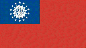
Current Flag of Burma (Myanmar)
Back to Top
Tourist Information Links
![]() Burma - Consular Information Sheet......This information page is for American tourists but will give you a general idea of travel requirements and useful addresses.
Burma - Consular Information Sheet......This information page is for American tourists but will give you a general idea of travel requirements and useful addresses.
![]() Trip To Myanmar......A well presented website from a recent(early 1998) traveller to Burma and other southeast asian countries. Many useful information including his travel itenary and a good collection of pictures.
Trip To Myanmar......A well presented website from a recent(early 1998) traveller to Burma and other southeast asian countries. Many useful information including his travel itenary and a good collection of pictures.